Warning

Warning: This site contains images and graphic descriptions of extreme violence and/or its effects. It's not as bad as it could be, but is meant to be shocking. Readers should be 18+ or a mature 17 or so. There is also some foul language occasionally, and potential for general upsetting of comforting conventional wisdom. Please view with discretion.

Monday, July 31, 2023

How Ukraine's Hydropower Authority Quietly Destroyed the Nova Kakhovka Dam

Part 5 of What Caused the Collapse of the Nova Kakhovka Dam? 

July 31, 2023 (slightly rough - edits Aug. 1, 3)

UHE and Russia's Chernobyl 2.0

Ukrhydroenergo (Ukr-Hydro-Energo - hereafter UHE) is Ukraine's largest hydroelectric company, restructured in 2004 from another company formed in 1994.  (Wikipedia) UHE operates many of Ukraine's Soviet-era and newer hydroelectric power plants (HPPs) and linked dams, and thus exerts control over many of the nation's rivers. On the Dnieper (or Dnipro) River, they used to run six dams and linked HPPS in their prized "Dnieper Cascade." The last of the six - Nova Kakhovka dam and hydropower plant - was seized by Russian forces on day one of their "Special Military Operation" in 2022 and occupied until it was destroyed, under disputed circumstances, on June 6, 2023.

It was only on June 1, a few days before that disaster, that UHE  proudly announced how it "has become a member of the International Hydropower Association (IHA)." Website: International Hydropower Association. It seems they could have achieved IHA membership years ago, but something had precluded it right past the Orange Revolution, the Maidan events, the Crimean secession and Donbass "Anti-Terroror Operation," Minsk, Zelenskyy, and one year of Russia's partial occupation of Ukraine. The issue might relate to now-ongoing anti-corruption efforts at UHE. ("Prevention and countering of corruption is one of the priorities of Ukrhydroenergo. On February 14, an online seminar was held with professionals on anti-corruption activities of the Company's branches." (Telegram

Ukraine has at times been recognized as the most corrupt nation in Europe. It seems UHE was - or is - no exception. They have a history of some members making secret, illegals deals for some kind of profit. UHE are also good patriots, as everyone must be in the face of Russia's invasion. Ending or at least complicating the Russian occupation of parts of Ukraine ... well, that's profitable to everyone, they'd say. In this light, they might conspire with Ukraine's military on some clever plan, even if it were technically illegal and would have to be denied.

Just a few days after UHE joined the IHA, both parties had a chance to lament the irreparable collapse of the occupied Nova Kakhovka dam and HPP. The IHA issued a statement decrying the "tragedy," citing some details from "our members Ukrhydroenergo, who operate the plant" (at least formally). To their credit, IHA passed on no premature propaganda about the Russians having blown it up. UHE, in contrast, seemed better-informed and was clear on this point, having it built into their very first comments, early June 6 on Telegram, citing military sources: "[Operational Command] "South" confirmed the detonation by the occupiers of Kakhovskaya HPP." 

On June 6, UHE's General Director Ihor Syrota declared: "We strongly condemn the terrorist act of the Russian Federation - the blowing up of the Kakhovskaya HPP. ... The hydropower industry is experiencing the most difficult times since the Second World War," he added. The dam could not be restored, but he promised in time "the Kakhovskaya station will definitely be re-built in the same place." Of course, the new dam could only be built once the area was de-occupied. Perhaps ironically, the old dam's destruction seemed to be assisting Ukraine's military in that very cause (see here for example).

From there, UHE would post daily on their website and Telegram channels, documenting the flooding and other effects of Russia's crime, maximizing its scale and importance, and demanding payback. They were on the frontlines of history, to hear them talk, but were sadly unable to stop this Russian plot. They would do their part by calling it out and to toss in some foreshadowing of the supposed plot to destroy the nearby Zaporizhzhia Nuclear Power Plant (ZNPP), which the Russians also occupied. UHE would state "By blowing up the Kakhovskaya HPP, the Russian occupiers caused the biggest man-made disaster on our continent since the Chernobyl tragedy.

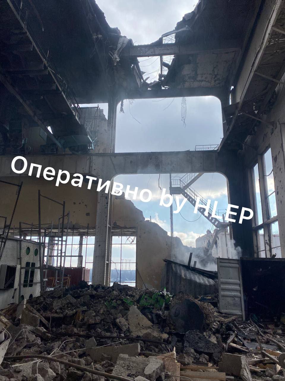
Within hours, UHE knew where the Russians had set their bomb. They announced June 6 on their website the dam collapsed following on "the explosion of the engine room from the inside." The area of the HPP engine room marked red below, on a mid-collapse drone video, would be somehow destroyed soon after this view. But this story gives no explanation for it remaining intact after the dam's partial collapse (between the white lines) some 20 minutes earlier. 

A later New York Times report would propose that the Russian bombs were set in a tunnel inside the dam where the first collapse happened. This would be reflected in later UHE explanations. June 30: "the Russians were already importing explosives and loading them into the lower tiers of the station." The engine room thing might have been secondary. Maybe they just didn't want to talk about that section of the dam, the one with the initial collapse, and where massive erosion took the deepest hold, near all those known and likely rocket impacts (blue oval above), dating from August to November 2022. 

Damage to the dam from Ukraine's HIMARS rocket attacks was seen in some photos, apparently dating from November and December, but released March 5 as "taken in March," and then re-released on the 25th at Grivna.ua (right: damage near floodgate 3). The latter mentioned no Russian attacks, but noted their military presence as the cause of the damage. The accompanying text has UHE's Syrota seeming to acknowledge but downplay the role of rocket shelling, emphasizing Russian theft and accidents caused by their Orkish negligence: "The Kakhovka HPP was damaged already, I think, eight months ago, when they (the occupiers – ed.) They were engaged in theft of equipment ... Then this led to accidents..." UHE "made an examination of everything damaged," estimating 16.7 billion hryvnias (about $454.6 million US). - the European Court has opened proceedings in this case," he said. Elsewhere, UHE and Syrota blame "Russian shelling" or "enemy air attacks" for damage to their dams totaling about $1 billion US (April 21). Nearly half of that damage is at Kakhovka and most of that was probably done by Ukraine. 

As my last post explained, it was probably not any explosives that collapsed the dam but pre-existing erosion, worsened by the Ukrainian rocket attacks UHE denies, and by overflooding that was directly engineered by UHEOnly increased input from the 5 upstream dams can rapidly rise the levels as happened. As such, Ukrhydoenergo played a key part in this, with major flooding from their dams running April to June. Part 2 related the data end of this, as recorded somewhat by HydroWeb virtual stations, but with quite a few suspicious gaps in the data. See below for some further details and when and how, and how UHE aided the cause with some timely misinformation about the floodgates. 

Much evidence suggests that Ukraine consciously weaponized the Dnieper River against the Russians, with Ukrhydroenergo acting as willing conspirators. The Russsian-affiliated dam managers may have been powerless to stop the assault, thanks to all their equipment being wrecked with the 2022 rocket attacks and likely sabotage. The central question of why the same 4 floodgates were left open for 6 months, feeding the intense erosion, remains open. The gantry cranes that open the gates may have been stopped by Russian design as widely assumed, or by malfunction or from attack damage, or quite likely they just lost power. Some claims from dam employees mention a power switch that was located on the Ukrainian side. The Ukrainians  might have simply switched it off - presumably by UHE or with their knowledge. If so, the Russians probably could not change that situation, as widely assumed. (see part 3 - Four Frontline Floodgates - and see below for how UHE dismissed the possibility of the cranes being disabled.

The heavy and narrowed flow was pulled into the erosion centers and worsened them, already causing a new, swerving flow pattern by January, 2023 as an existing erosion center seems to migrate to join with new damage. It seemingly collapsed an attached roadway on June 1 or 2 before it spread under the dam itself in the final days. UHE helped maintain that flow and made sure the dam was holding a maximum and high-centered water load when it was undermined. 

If anyone did set off some bombs just then, it would be quite a coincidence, precluding any blame on UHE for the fact that the dam was already set to collapse. Otherwise, they collapsed the dam. 

If this had happened on accident or through no effort of theirs, UHE might have noted the situation emerging and done something to correct it. But they seem unaware or willfully ignorant of the danger as they kept adding to it, with a late and rather massive "spring irrigation." They gave a lot of reasons for this in advance, but then carried it way too far in the final 9 weeks with as little comment as possible, as if they hoped no one would notice until well after it was too late. 

UHE and the Fall River Offensive, Winter Interlude

The history of this collapse plot may go back at least 9 months before its culmination. Hydroweb (theia-land.fr) shows water level at Lake Kakhovka back to 2016. The historic trend has the reservoir filled to a minimum of 15.5m and a maximum of 16.5m, with only slight and brief exceptions. Even after the Russians took over management in February, 2022, water levels were maintained within norms until the middle of September. But from then to the end, the level started fluctuating on an ominous scale, just passing the normal range between rapid spikes well below and well above it. 


Here's the first part of that erratic span in detail, with two surges and then the record lows. (with notes, as explained below - normal range in pink). 


First, between readings from September 11 and October 4, the water level rose 0.5m, to just past normal, and rather quickly. A satellite photo of the 18th shows steady discharge from, I think, six floodgates across the middle, being 5, 7, and 9 and 13, 15 and 17. Sentinel Hub's less clear views show no flow on October 3, then heavy flow from the middle in all available views, including Oct. 8, 11, 16, 18, 28, and 31, before the gates are all closed by November 2. As shown above, that's when the level was down to the bottom of normal. 

I'm not sure of the weather then, if heavy rainfall alone might explain this. It might be an early flooding effort, but not a very good one if so. This came after the dam's bypass lock was plugged in early September, but all 28 floodgates on the dam, all 6 at the HPP, and 2 canal pumping stations were functional in September. 

The possible second try would be clearer. Major General Andrey Kovalchuk, head of Ukraine's 2022 Fall offensive in the Kherson area was famously cited in a December, 2022 Washington Post article on The Ukrainian counteroffensive that shocked Putin and reshaped the war (archive.org) Kovalchuk spoke of a Ukrainian "test strike" on the Nova Kakhovka dam to "see if the Dnieper’s water could be raised enough to stymie Russian crossings but not flood nearby villages." Kovalchuk's "test" attack was undated, but said to put three holes in the metal of a floodgate, and to be deemed success. A floodgate was damaged in a November 6 attack, per Russian sources. Floodgate 1 was seen badly damaged by early December, and gate 1 shows otherwise unexplained irregular flow, as if from that damage, by views of November 10 and 12. And so that was Ukraine's "test strike" - floodgate 1 was damaged, probably as said on November 6.

For some reason, there was new "concern" in Kyiv for the dam's wellbeing just then; it was feared that the Russians might try to destroy it soon. UNIAN, Nov. 7: The expert told why it is not profitable for the Russians to blow up the Kakhovka hydroelectric power station "If the Kakhovskaya HPP is blown up, Crimea and the positions of the Russians will suffer, a military expert said - Military expert Serhii Grabskyi believes that the Russians should not do this "in view of the healthy sense"..... "But, understanding who we are dealing with," (probably Ukraine in a thin disguise) "such a version cannot be completely ruled out," he clarified." The article adds "Grabski is more inclined to think that statements about the undermining of the hydroelectric power station are a "horror story", an information and psychological attack." It's never clarified who had first made these statements. 

These comments were shared on Telegram by SPRAVDI (Ukraine's Center for Strategic Communications and Information Security). It's as if they were trying to talk the Russians out of blowing up the dam, but the same thoughts might have already talked Ukraine into doing it for them.

Between November 13 and December 2, Hydroweb records show the water level on the Kakhovka reservoir rising even more rapidly than it did in September, at least 0.74m by December 2. For a reservoir this size in 19 days, that's substantial. It might have gotten even higher just before that or just after that reading, but before a net decline that appears by December 10. Starting a week after the floodgates were damaged in a "test" about raising water levels, Ukraine was raising the water level. This came after the lock was plugged, and after the HPP and its 6 gates were disabled by a disputed attack probably on October 24, but before the Khakovsky main canal pumping station was wrecked in disputed shelling on November 30. The Russians had both pumping station and now 27 24 floodgates on the dam (gate 1 could not be opened after the damage, and - Add Aug. 3: then at least gates 26-28 were made inaccessible on the 11th, under the roadway and rails the Russians blew up). It might be a better time to expand on that "test" by raising the water input.

No floodgates at Kakhovka were open on November 12, but likely in response to the rising water, floodgate no. 5 was opened by a video dated the 13th, seemingly in the evening. Then the gantry cranes that open and close gates were moved, opening perhaps gate 3 as well by a satellite view of the 15th and finally 2 or 3 more were opened at some point, for 4 floodgates (3,5,6 & 7) pouring water. That last change might have been in early December, when the rise is suddenly reversed into a decline, about 2/3 as steep as in October (when 6 gates were opened). The north crane was positioned just above gate 8, but never got it opened before the cranes froze. It seems they never moved again until they fell into the river in June. Again, the Ukrainians might have simply switched off power to the cranes and, if so, the Russians probably could not change that situation, as widely assumed. 

Whatever the cause of it, with the constant outflow of those 4 gates, the water level fell much like it did in October, but this time without stopping. Besides high output, there was low input as UHE's dams seemed to hold water back, for whatever reason, storing it through the winter. In April, there were warnings of flooding around the Kyiv HPP that, as Flash News would report April 13, was "a result of the skipping of spring irrigation through the Kyiv HPP." They decided to hold back their usual spring flow, risking local flooding of areas north of the capitol, maybe for some reason, like saving it up for some project. We'll come back to that.

The Russians also syphoned water off Lake Kakhovka to their North Crimean canal and maybe by the "main" canal to largely Russian-held areas like Melitopol. Between all of this, the Kakhovka reservoir fell to record lows slightly below 14m by early February. (at right: a photo that was circulating at the time) 

One effect of this was giving Ukraine a supposed Russian crime to complain about. A February NPR report would relate how "Ukrhydroenergo, Ukraine's hydro electric company believes the discharge is being done deliberately by the Russians," hoping to harm Ukraine with low water levels.  Among the things threatened: local agriculture (mostly in Russian-occupied areas) - the North Crimean canal (and water for the Russians there) - the cooling pond for the ZNPP (Russian-occupied and managed, but in no immediate danger as long as its cooling pond remained full). This comes besides the losses in hypothetical hydropower, if the plant hadn't been disabled by attacks already in the fall (and if the HPP were running, it's not clear where the energy would have gone). 

UHE and Pressure Plans in February

On February 8 UHE informed its followers on Telegram that "International influence is needed to eliminate threats on the Dnieper cascade. " This related an interesting meeting on the theme that occurred two days earlier.

On February 6, an extraordinary meeting of the State Commission on Technogenic and Environmental Safety and Emergencies was held under the chairmanship of Prime Minister of Ukraine Denys Shmyhal. 

The Commission considered a number of important issues, including the state of filling the cascade of the Dnieper reservoirs and possible risks to the water supply of Kherson, Zaporizhzhia and Dnipropetrovsk regions. The participants heard information from the Minister of Environmental Protection and Natural Resources, as well as the First Deputy Head of the ZOVA Hennadii Timchenko, other officials on the water level in the Kakhovka reservoir and possible negative consequences in case of its further reduction."

According to the observations of Ukrhydroenergo experts, the large volume of water discharged through the Kakhovskaya HPP is not due to its damage, but to the deliberate actions of the Russian occupiers, who opened the plant's sluices, fearing that the Ukrainian military would forge the Dnieper. 

It was UHE that promised the PM, the president, and the world that the occupiers could close the floodgates or open more, even though they likely could not. The UHE experts claim the gates weren't damaged, which was mostly true. But they didn't mention whether they had power, which they apparently did not have. If Kyiv's answer based on this advice was to send enough water it could withstand more floodgates opening, and then any disaster followed on their failing to do so, UHE assured them it would be the Russians' own fault. From a "Technogenic and Environmental Safety and Emergencies" perspective, it could not be blamed on Ukraine. 

In this regard, the Prime Minister ordered the preparation of informational materials for the President of Ukraine regarding the real situation around the Kakhovskaya HPP and reservoir in order to give it public international publicity. In the current situation, the only real way out of the situation is international pressure on the occupier to force it to close its doors and prevent humanitarian, environmental and nuclear catastrophes from unfolding.' 

In the following days, that NPR article for one (Feb. 10), told the outside world about "the real situation," aided by Ukraine/NAFO meteorology ally David Helms. Everyone was worried about the falling water level at Lake Kakhovka, due to the Russians willfully keeping so many floodgates wide open. Kyiv had raised international public pressure on the occupiers.

With this public backing and those assurances, Kyiv also pursued a more direct, national, and secret policy of water pressure to go with that. They had extra water stored up behind the 5 Ukrainian-controlled dams in the "Dnieper Cascade" and, as part 2 outlined, they had these send all the water they could into Lake Kakhovka, along with extra-heavy rain in April. This would be overseen by UHE, and all of the water had to pass in shifts through at least the final dam at the Dnipro HPP, next to Zaporizhzhia, which would handle the direct injections all the way. 

Interestingly, it was just then - Feb. 9 or 10 - that the same Dnipro HPP was damaged in an attack, as reported by a few pro-Russian sources at the time, and some pro-Ukrainian ones a bit later. See my Twitter thread and note there's probably more to learn, but it was so hard to find I put that off. A BBC report, for one, mentioned a February attack (undated) and also an earlier attack in December. For no obvious reason, the UHE website and Telegram channel make no mention of either of these or any attacks, that I could locate, until President Zelensky visited on March 27, when photos and video of damage were published: "the consequences of Russian missile attacks on the Dnipro hydroelectric power station, in particular, they inspected the building and power equipment, which suffered significant destruction." (UHE on Telegram). That video and another and some photos I found (link... - one at right) show severe damage to the southwest corner of HES-1, with smoke still rising from the rubble, as if it were from a new attack in late March, a third attack to go pretty much unreported.  

The direction of fire is unclear to me, but the damage suggests it's from the left/north (Ukraine) or the right/south (Russia) - not from east or west. I think from the north is better suggested, but that's not certain, and the logic of either side doing this raises questions. In brief:

The February attack could give a quiet impression that Russia wanted low water so badly they attacked the one dam that might slake their thirst. The proper response would be to spite the Russians by finally sending more water, as they may have already planned to do. Maybe the Russians sensed the flooding plot to come, and this was their way of warning that off, but it sadly backfired. Did they provoke a counterattack here? 

Or did Kyiv provoke their own plan on Russia's behalf? They might have adequate motive in December or February, and more so in late March. It might sound bizarre, but consider if they were engaged in a plot to destroy a dam, they might risk some repairable damage to another dam, if that served some purpose as a trigger. You would think they'd make more public noise about a false-flag attack, or about a real attack, for that matter. But maybe the revenge was too secret to draw attention to by even addressing this provocation openly. It might be for "internal consumption." For example, dam operators might be angry, and willing to play along with a flooding plot as some kind of revenge. And that might apply especially if this worst attack were in late March, to "justify" the reckless flooding of April and May (see below). 

Dnipro HPP outflow as seen in satellite views from Sentinel Hub EO Browser (sentinel-hub.com): outflow from the two power stations here, HES-1 and HES-2, is often hard to make out or easy to make up. But it seems several gates on the east end of HES-1 show a high output rarely seen last year. It starts early, by first views in January, continues on 2/5, and the same width but seemingly stronger on 2/20, and continuing 3/2 and forward. But on the receiving end, Lake Kakhovka clearly starts rising after Feb. 10, or right after that alleged attack at Dnipro, so their output probably increased around then. 

It's not clear why, but two days later, on February 12, video was posted of Ukrainian drone attacks destroying cameras at Kakhovka HPP, Everyone there could see the new attack anyway, as the water started pouring in. At first, it would look like a good thing in the parched circumstances, but that would change.

UHE and the Spring River Offensive

With the winter thaw, and perhaps two months of held-back water, the northern reservoirs had unusually high levels in the early spring, ahead of unusually heavy rains in late April. Lake Kremenkutska is the other big reservoir in the Dnieper cascade, well north of Kakhovka. Each lake usually held nearly half the water in the system. See in Hydroweb's water volume log how Kremenchutska prepared for the heavy mid-April rains - it filled massively over February and March with little output, it seems, rising from 0.5 to 3.5-3.7 cubic kilometers. 

It did much the same in years before, but not this quickly and not this early. This might invite disaster once the heavy April rains came in. The level seems to hold steady even then, so a lot must have been shed, and several entries are missing (see lack of dots on those straight lines between mid-April and mid-June). 

Multiple floodgates are seen pouring in Sentinel Hub views from April 24 to May 4, so for at least that span. April 29 view at right.  

As noted, Kyiv HPP to the north was holding winter melt until mid-April before it shed some and helped maintain that high level at Kremenchutska. Flash News would report April 13: "In Kyiv, the Dnipro may overflow its banks. The first level of danger has been declared, the Ukrhydrometeorological Center reported. "As a result of the skipping of spring irrigation through the Kyiv HPP, the water level of the Dnipro River in Kyiv and Boryspil district of the Kyiv region may reach dangerous levels of the initial flooding of areas adjacent to the riverbed," the message says." On April 15-18 photos appeared of flooding around the capitol. https://twitter.com/Geoff_WarNews/status/1647232587906072576 -- https://twitter.com/suspilne_news/status/1648348339019063296

This state would continue a few days, then rapidly subside, with a 10cm drop reported by Flash News in one day (4/20 vs. 4/19). Sentinel Hub views show a new heavy flow from open floodgates at Kyiv HPP on April 22 and 25, new since an April 7 view, and quiet again by May 2. (see below) This was sent to the Kaniv reservoir and then passed (4/17 view below with several gates open) into Lake Kremenchutska. There it would replace the excess water just sent on, and this new excess would be sent on in the same way. 

Wider flood situations at other reservoirs on the Dnieper were reported in April and May, largely by pro-Russian sources and generally denied by UHE and Ukrainian ones. At several points, it seems disaster was invited, briefly accepted, and then sent downstream in shifts to correct and then drastically over-correct the engineered shortage at Kakhovka. It all seemed to make complete sense, up to a point.

In part 2 - Did Ukraine Break the Dnipro River and the Nova Kakhovka Dam? - , I documented the overall decline on the upper Dnieper as Kakhovka was forcibly filled, via Hydroweb virtual stations that recorded a net drop at several points, usually around 20cm, between late March and late May. Widespread missing entries make it unusually hard to track in detail, but the big picture is clear enough - water was stored up and then rapidly shed to flood Kakhovka all spring. The rest of this post adds some to that picture.

After Kyiv, Kaniv, and Kremenchutska, water was sent to Kamianske HPP and then Dnipro HPP (see reference map below), There it would replace a new outpour that began by early April, in turn answering the suction of a dried-up Lake Kakhovka. And so excess water was on Kyiv's streets in mid-April, then shunted down probably to Kakhovka in time to assist in the dam collapse there 6 weeks later.

As the water level there remained low but steady in late March, UHE and its general director Ihor Syrota kept playing up the danger of a new Russian drawdown, sowing public reasons why increasing the flow to Kakhovka might be a good idea. On March 24, uhe.gov.ua and UHE on Telegram announced:  "Since the middle of February, the issue of the threat of the Russians draining the Kakhovsky Reservoir has become acute." This sounds like it's gotten worse, but the levels were improving exactly since mid-February. Syrota is again quoted: "The manipulations of the Russians with the gates of the Kakhovskaya HPP have no logical explanation." Again, my best guess is Ukraine turned off the power to the cranes, hoping to maximize the ensuing erosion. I doubt they have any better reason to suspect the Russians were intentionally - and illogically - keeping the same 4 gates open for months on end, when their final plan was to blow the thing up with bombs. 

The same message cited a Syrota interview with "BBC journalists" to say that "Ukrhydroenergo hopes that it will be possible to maintain this reservoir level by June." 

On March 27 Syrota again spoke to the media. As Reuters reported, he "voiced concern about what would happen if water levels fell further at the Kakhovka reservoir ... The level has fallen because Russian troops ... have let some water out through sluice gates, he said." After speaking as if the levels were still declining, "Syrota said the level had risen since then thanks to the winter thaw" and to UHE's dams passing some of that along, in part to just be wasted out those 4 open floodgates: "They (the Russians) are discharging a certain volume and we have raised the level to 14.30 metres from 13.50-13.60 metres. But still the gates (of the dam) are open," Syrota said. 

"We have raised the levels," he says, and UHE "hopes that it will be possible to maintain this reservoir level by June." They wanted to keep a high input to Kakhovka, hoping to outpace the Russians' floodgates. Those never did vary their pace, but it seems UHE always anticipated they would, and chronically pre-corrected for it. It would be a massive task, but they made it look easy, outpacing the steady outflow and "maintaining" the level all to heck by early June. That "hope" seemingly guided their efforts in between. 

UHE never mentioned any danger of OVER-filling the reservoir. It's as if the idea had never occurred to them. And so, perhaps without noticing, through April and May they raised the level at Lake Kakhovka further and further, to the normal range and well past it, until the reservoir was 100% full by early May. 

UHE boasted on April 19, even as peak rains were expected on the 22nd, "As of April 19, the water supply situation has stabilized. Now the flood is receding. #Ukrhydroenergo hydroelectric power stations on the #Dnipro and #Dniester regulate [water] levels, avoid flooding, and continue controlling discharges in compliance with safety standards." 

This is also about when the video appeared of Dnipro HPP pouring water, which some would later say was filmed AFTER the dam's collapse in June. Twitter user Aurora Borealis would post this on 4/19, explaining "For the first time in several decades, 4 floodgates were opened at the #Zaporizhzhia HPP to release water and save the central Ukraine from flooding." The video shows water pouring from at least 4 floodgates and perhaps more. It pans to show the river full of foam, with the outflow from HES-1 visible on the right, also sending water downstream. HES-2 across the way might be doing the same. 

This marks a major escalation in the river offensive. It didn't start on the 19th, but earlier. Sentinel Hub EO Browser views show this flood of perhaps more than 4 gates by April 16. That's after no views since March 27, when it seems no gates were open (see below). It's on March 29 that a new level is quickly achieved at Kakhovka, then between April 2 and 9 it increases a bit in speed, holding that pace for about a month. So that's probably when Dnipro was first opened like this - maybe 2 gates around March 28/29, then more in early April. Recall as noted above there may have been a new attack on HES-1 around March 26. Did an attack precede this outpour, like may have happened in February? 

The floodgates were pouring some three weeks before that video, and Lake Kakhovka would pass the normal range to a dangerous level a few days after it. This was done "in compliance with safety standards," of course, and "to save the central Ukraine from flooding" but it would prove terribly unsafe and cause severe flooding in the Russian-occupied south a few weeks later.


On April 20, UHE board member Stephen Laird Walsh visited Dnipro HPP in an army helmet, in light of the recent, little-noted attack(s) in December, February, and/or late March. He posed frowning with a weapon remnant, and smiling in front of the UHE-controlled floodgates pouring away.  He's seen bemoaning one attack weapon, and blissfully unaware of the other one raging behind him. 

Sentinel Hub views show this flow continuing to at least April 26, but it's done by May 6, and these floodgates seem to stay off thereafter. The Kakhovka reservoir records being 100% full by May 8, but by the speed of rise to the last reading on 4/28, it would be full around May 2, The major flooding lasted about one month.  A light output from the two HPPS, HES-1 and HES-2 seems to continue that whole time and remain after, seen running on 5/6, and in all clear views: May 16 and 21, and even on June 5. This smaller input must have roughly matched the outflow from Kakhovka, as the level was maintained that whole month to collapse. 

After the collapse, HPP output seems to continue, and it looks kind of like one dam sluice gate on the east end was opened AFTER the collapse, as seen on 6/20 to now (7/30), but "pouring" just the same in every view except for getting a bit bigger - it's more of the riverbed exposed after the reservoir drained away, where some trees were often visible alongside HES-2 - a sort of natural divider there. So FWIW, I see no sign of serious flooding after the collapse, and there is no great reason for it - the military probably wanted the reservoir gone and then dried up, not endlessly flooding. They would want Russian defenses washed away in a flood, not left underwater forever.

Now for the story in data. Below is the record on the receiving end of this over-zealous "flood-prevention" work that caused one of the greatest modern floods: Lake Kakhovka water level from Hydroweb, February to June, with notes. 


Note that 4 floodgates keep pouring from the reservoir - at the same rate, barring pressure difference - this entire time. What changes is mainly how input matches and then exceeds that output, and keeps exceeding it. The maximum possible level was reached before May 8. Input didn't stop then but lessened, keeping a rough parity through May, with a tendency to decline - so input remained a bit less than what the 4 gates released. There was a slight decrease by May 10, and that was held to May 20. Then a mystery refill was recorded the 21st, possibly from increased input. That's corrected by the 25th, and we see a slight improvement to maybe 99% full just before the end. Despite the variations, in all views of May 11, 29, June 1, 2 and 5, the dam is overtopping - full to the brim and splashing over. Somehow, even higher levels than this can be measured somewhere on the reservoir.

Note the input isn't completely heedless or blind. The people at Dnipro dam knew when the reservoir was at 100% full and chose then to decrease their input so as to just maintain that level. This shows awareness of the situation and responsiveness to it. So why was the response generally so imbalanced, so grossly at odds with professional safety standards? 

At right is a map of all dams and falling vs. rising levels at Hydroweb virtual stations, from part 2. Adding here from a look at Sentinel Hub views for the other dams: between cloudy and blank days, there are some good views for each facility. With one example link each, and going north-to-south, all the usable views show:  
- Kyiv HPP: quiet 4/7, some floodgates pouring 4/22, 4/25, quiet 5/2, unclear on other days
- Kaniv HPP: quiet 4/7, pouring from 3 floodgates on 4/17, 2 gates 4/22, prob. 4/24 (just off-frame), and on May 2. unclear May 4, 7 & 9, but quiet by May 12.
- Kremenchuk HPP: - no good April views until solid output seen 4/24 between the clouds, and clearly on 4/29 and 5/4, seemingly 2+ floodgates open, then quiet by May 9.
- Kamianske HPP: solid output from most of the gates on 4/19 view, perhaps less gates on 4/24, 4/26,  quiet again 5/6
- Dnipro HPPs: as mentioned, heavy floodgate pouring seen 4/16, 4/26, and done by May 6 - probably running late March to early May, with the HPPs sending water the whole time from January to June and after. 

Extra-Quiet for the Final Stretch

From the Dnipro floodgates opening to the Kakhovka dam bursting is approximately nine weeks of what almost has to be a deliberate flooding effort. This came after the dam's lock was plugged, after the HPP and its 6 gates were disabled, after the Khakovsky main canal pumping station was wrecked, after the North Crimean canal had all its reservoirs filled, limiting its usefulness, after floodgate 1 was damaged, and after the gantry cranes were disabled, allowing no change in the floodgates. They had the four frontline floodgates trying to relieve the pressure and, most likely, little else that could be done. They boasted of getting one HPP floodgate open in early May, and the visual record might suggest increased flow just then, but it somehow stops again within a few days. (see part 3) It was in that badly plugged and unmanageable situation that UHE's input outpaced Kakhovka's output so massively they filled the reservoir to 100% and then kept it close to that for a month.  

Allied sources unwittingly drew attention to some important effects of UHE's unorthodox river management, which the company itself seemed to ignore. Of course they tried to blame it on Russia. 

NYT, May 17, complaining of the dangerously high water level: "It is unclear exactly how the water level rose so significantly since then. But David Helms, a former U.S. Air Force and National Oceanic and Atmospheric Administration meteorologist who researches the dam, said that Russian forces seem to have kept too few gates open to control the flow of winter snowmelt and spring rains. Likening the effect to a leaky bucket, Mr. Helms said that too much water has been entering the reservoir. “What the river is doing is dumping a lot of water in,” Mr. Helms said. “And it’s far exceeding the discharge rate.”

Helms makes no sense. He was just complaining the Russians left too many gates open, and now he says it's too few. Leaky buckets let too much water out, the opposite of the supposed problem. And the river "dumping a lot of water in" was controlled by Ukraine, so Ukraine was dumping in far too much water. There is no way the Russian managers could stop the input from Dnipro HPP, and they likely could not open any more floodgates. 

Pro-Kyiv Nova Kakhovka news on April 28 shared a drone video of "spontaneous discharge of water due to damage to the Kakhovskaya HPP," mentioning "the high level of water in the reservoir and its powerful discharge in places of destruction." Note the divider between the dam and HPP outlets had its end crack free and settle at an angle, evidencing serious erosion near the dam. The Russians were pouring way too much water, and also not pouring nearly enough water. The reporters don't seem to care why that has become possible.

The same Nova Kakhovka news would show another video on May 16:  "The video taken on May 11, 2023 shows that powerful streams of water are flowing uncontrollably through the open and partially destroyed by the occupiers locks [floodgates] of the Kakhovskaya hydroelectric power plant. The increased water level in the Dnieper River and the flooded coast in Nova Kakhovka can also be seen, ... as a result, the positions of the occupiers were flooded." Again they note the reservoir is full, even fuller now and clearly overtopping, despite pouring "uncontrollably" to disastrous effect, for the occupiers, whose fault it somehow was.  

The high level and heavy output coexisting means the dam was sorely overloaded and unmanageable, especially under the battered circumstances. To the extent the outside world saw this problem, it seemed like something mysterious and probably Russian was to blame. But Ukraine's dam operators were keeping the pressure on, heedlessly or otherwise. 

UHE was the agency making this happen, but they had nothing to publicly say about it, to acknowledge or deny it, let alone explain why. They had nothing new to say about this dam, aside from blaming Russia for all the existing damage and hitting them with the bill for it, and nothing about Lake Kakhovka, except to note in late May that it was the one reservoir they had no comment on. All Telegram entries from these days wherein UHE even mentions the endangered dam:

Telegram, 3/28 Ihor Syrota: "We need significant funds to restore our facilities that were destroyed or damaged as a result of enemy air attacks ... The Russian occupiers caused 16.7 billion hryvnias worth of damage to the Kakhovka hydroelectric power station alone." The Russians caused damage not just with theft and negligence but also with "air attacks?" Or is that just tacked on? Is their actual bookkeeping on this any clearer?

Telegram 3/30: "On this day, March 30, 1952, a historic event took place at the construction site of Kakhovskaya HPP - the first cubic meter of concrete was placed in the construction of the hydraulic unit!" On the 71st anniversary of that day, UHE was beginning or about to begin the lethal overflooding of Lake Kakhovka that would tear much of the dam away, but that first cubic meter might have remained.

On April 21 UHE said "We estimated the company's direct losses, including due to the occupation of the Kakhovskaya HPP, at approximately 1 billion dollars." May 17: "special attention is paid to the issue of restoration of the Kakhovskaya HPP after de-occupation." They had raised the water level to 100% full a week or two earlier, and would seemingly add more around May 21, to help keep Lake Kakhovka full until the dam collapsed. In this way they may have destroyed the dam before they could collect the money to restore it. 

On May 29 UHE would mention NK and its reservoir one last time before the collapse, announcing  "the decline in water levels continues ... As a result of water harvesting through the reservoirs of the Dnieper Cascade, fluctuations in water levels were observed within the range of 1-10 cm per day, with a predominance of subsidence. The volume of water in the cascade of the Dnipro reservoirs as of May 28 was equal to 47,616 cubic km, which is 3,768 cubic km higher than the volume of reservoirs at the normal support level (NPR), without taking into account the Kakhovsky reservoir, the volume of water in the cascade is equal to 27,116 cubic km .km (by 1,458 cubic km exceeds the volume of reservoirs at the NPR)."

Why were they not "taking into account the Kakhovsky reservoir," at least when speaking to the public? They had "raised the level" since March, "maintained" and even exceeded that level greatly, here at the cusp of June. Isn't that what they had promised? Don't they want to take credit for all their hard and well-organized work countering the Russian's drawdown plot, and doing it all while balancing upstream needs, as they boasted of rapidly falling levels at all of their reservoirs? 

On June 1, as mentioned, UHE joined the International Hydropower Association (IHA), and then the roadway collapsed from UHE's erosion, probably accelerating it greatly. The final days saw more proud statements on their management of the river - aside from its final stretch, which they no longer mentioned. June 2: "There is a decrease in the flow of water along the rivers. Water levels in the reservoirs of the Dnipro Cascade continue to decrease." Well, not at ALL of them. Mid-day on June 5 they would repeat this"As of June 5, the water level continues to decrease. Hydroelectric power plants carry out the passage of spring irrigation on the Dnieper Cascade through hydro units." 

As of June 5, they continued to pour water from reservoirs in no danger on downstream, perhaps right into Lake Kakhovka, where the danger was so real it was about to become actual disaster. Its level hadn't risen in a month because it couldn't - it had been 100% full, despite still pouring from 4 gates AND overtopping. Erosion was taking down structures increasingly attached to the dam. At this point, collapse was all but certain in a matter of hours to days. 

Conclusion

If anyone did set off some bombs just then so the dam never did collapse on its own, it would be quite a coincidence. And if it was a Russian plot to store all that water and then blow the dam and cause maximum destruction - primarily of their own defenses and occupied villages and fields - why were UHE's dams still carrying out "passage of spring irrigation," helping that plot by sending them so much water right up to the end? 

"Russia's plot" was probably Ukraine's plot and thus UHE's. They were quite likely assisting the Ukrainian military to collapse the dam and re-shape the battlefield to Kyiv's advantage. It's why they knew not to talk about the situation as they helped engineer it.

It's not quite Chernobyl 2.0, but Ukhrhydroenergo was instrumental in this disaster. Through criminal conspiracy or a massive and probably criminal type of negligence, they caused the deaths of dozens to perhaps 100+ civilians, displaced tens of thousands, caused a wide-ranging "ecocide," contaminated water supplies, wrecked huge swathes of important crops, threatened disease outbreaks, destroyed hydropower potential, endangered a nuclear plant, and more. All the stuff they eagerly blamed on Russia was largely the result of UHE's own misguided actions. 

It's the kind of crime there should be a price to pay for. But it's also a crime that's very difficult to fix an Earthly price for, and one that assisted in the grand Western strategy of bleeding Russia, This calls for dealing Russia blows and devastation everywhere, and trying to hit them with the blame and the bill for all of it. So from the NYT to NPR and through any investigations by Western-controlled or compromised bodies, the Western-led "global community" will try to push this through on that same script, or at least prevent the truth from coming to light. 

Tuesday, July 25, 2023

Nova Kakhovka Dam: How the Dam Was Undermined

What Caused the Collapse of the Nova Kakhovka Dam? 

Part 4: How the Dam Was Undermined

July 25, 2023

Bombs vs. Erosion and the "Paper of Record"

Part 2 in this series covered the hydrologic overload that kept the reservoir of Lake Kakhovka 99-100% full for one month despite intense, non-stop outflow from 4 floodgates. Part 3 considered why those same 4 floodgates stayed open for 6 months straight, narrowing the heavy flow. That's still a mystery, but I suspect Ukraine turned off the power source, located on their bank of the river, for the gantry cranes needed to open and close the gates. As I'll explain here, that constant, heavy, and narrow outflow seems likely to have fatally undermined the dam with erosion by early June. I can't rule out that explosives were used to destroy the dam, but if so, it came with the coincidence that it was likely to come very down soon anyways. 

We'll start with a widely-cited New York Times article from ten days after the collapse that found for explosives over erosion, but in a very unsatisfying way. Their evidence, in summary: the seismic record suggests a blast, or rather the two blasts their story needs (debatable), US satellites were said to pick up "infrared heat signals that also indicated an explosion" - one of the 2 required (no details like exact time, degree, or location), and how from the deep central flow after collapse, it seemed like "the foundation had suffered structural damage" that couldn't be caused by any piddling rocket impact to the top, which might have made this partly Ukraine's fault. 

By this, a bomb seems possible but far from proven. It could be done by either side if so, especially considering motive. But the writers skip this, and overlook the abnormal flooding and other clues to conclude the dam was doing well enough until the side with better access but unclear motive - the Russians - must have bombed it from the inside. That was another big clue for the Times: the Russians could do it from the inside, totally unseen by drones or satellites. That's eerily true! They could have ....

The report points out that "the catastrophic failure of its underlying concrete foundation was very unlikely to occur on its own." It suggests the Russian bomb(s) were set in the "drainage gallery," a tunnel at the dam's "base" that ran to both sides of the river, but was guarded by Russia and presumably blocked to Ukraine. It turns out the Times' graphic moves the tunnel well towards the bottom of the dam, compared to the blueprint design I've seen, and makes it bigger. Here are the 2 views overlaid with notes added. A blast just below the floodgates would still be a serious issue for the upper structure, and might explain the observed flow, but it's far less likely to effect the deep foundation than their graphic implied. 

Erosion of the subsoil, in contrast, would only compromise the dam from its very base, although cracks would appear all over, especially at any prior damage points, and upper sections would still be more likely to tear free in the torrent. That is, the end effect could be about the same either way, as far as I know.

Pause for Reference: 3D Blender model by Chris Kabusk, labels added. Gallery of views: Kakhovka Dam [Blender] - Imgur 


The dam runs SE to NW (right to left here), 2/3 filled with 28 basic floodgates numbered right-to-left, done in red. Note that gates 3, 5,6 and 7 are raised, or open, as they were all through 2023. Gate 12 is actually red, somehow taller, or open but with another gate blocking the flow - it's effectively closed. Gate 1 and gates 26-28 at the far ends were closed but leaking from damage caused by both sides. Blue gantry cranes that open the gates are numbered the other way around and here are the south & north cranes, parked for months over gates 3 and 8. South/right end is the hydropower plant, its own 6 floodgates gates, and its own gantry crane (hidden behind in this view). The dam and HPP each have a water "outlet" running, as shown, to 100m from the water ramps, with a divider between the outlets. Most of this is atop the concrete "apron" or basin about 3m thick, with the inner part of the dam outlet covered in 4 meters of concrete. This model shows the entire apron/basin. I'm not certain just what kind of bottom there was past this.

And here's a short review of explosives at the dam. Some were fired in rockets by Ukraine, or some say by the Russians, from early August to early November, causing widespread but non-fatal damage near the HPP and floodgates 1-5. Then it seems Russians had blown part of the roadway off the top of the dam after they retreated last November (over gates 26-28), then "mined" it and/or planted explosives-filled cars on the remaining stretch, all to keep Ukrainian forces off the bridge. Those car bombs never detonated. One of the mines might have gone off during the collapse, injuring a seagull. None of it caused the collapse. 

Kyiv also accuses the Russians of importing explosives into the dam's interior. By reports from dam employees, including to OSINTJOURNO, the Russians had blocked or "blew up" the north entrances to the drainage gallery to keep Ukrainians out.  ("The Russians were concerned that the Ukrainians would misuse the drainage gallery of the dam" tweet.) Then they reportedly mined it with explosives - likely smaller anti-personnel ones, in case anyone managed to break in. ("In March, the Russians already blew up the entrance from the northern side, and since then, they have completely undermined the drainage gallery by placing explosives at various locations in the "drainage holes" and "curtain grout holes"." tweet) This isn't a certain fact, but it's likely enough. These "grout hole" bombs might be triggered by tripwires or motion sensors, or may be triggered accidentally by an unexpected event, like the dam starting to collapse on its own.  

Bombs alone, as the Times proposes, would require 2 bombs or 2 phases. There was an initial blast and/or collapse at 2:35 am, after which the span from gates 1-9 were seen missing, and then a middle section of the HPP engine room also collapsed 20 minutes later, with a seismic reading that looks the most like explosives. As first published, with my labels, this may show a blast for 2 seconds, or perhaps several smaller ones. Then it shows 20 seconds of the dam collapsing, with cracks even louder than that possible bomb(s) - all 20 minutes AFTER another section must have been bombed with a notably quieter blast (not shown here). 


I don't know of any credible evidence for explosives in the HPP engine room, aside from its collapsing separately, and apparently with the louder signal shown above. But it's possible. Otherwise, the mined drainage gallery ran under the place, or maybe just up to it, with a direct doorway connection. NYT: the gallery is "reachable from the dam's machine room," and vice-versa. So for what it's worth, any Ukrainians who got into the tunnel without being blown up might be able to access the engine room as well. Some delayed blasts there or in the tunnel below, coming amid a partial collapse, could set that whole section floating down the river.  

But then again, this might be a natural second phase of an ongoing collapse, with cracks that come on suddenly and read almost like a bomb blast. 

Mining the drainage gallery sounds reckless, but the explosions might be small and non-fatal to the dam under normal circumstances. A collapse would be abnormal circumstances and there were more of these in the months leading up to it. It seems there was heavy erosion of a kind the Times' experts apparently didn't know about. They considered it an unlikely possibility when, as I'll show, it's closer to a visually proven reality. Gregory B. Baecher, an engineering professor at the University of Maryland "said it was possible, though unlikely, that water flow from the damaged gates somehow undermined the concrete structure where it sat on the riverbed." But he noted design features we'll consider below, including "a so-called “apron” of concrete on top of the riverbed to the downstream side of the dam," that would make this unlikely. This is exactly the right first impression to get, but there are second impressions in order here.

The article - if not their experts - did take note of some important evidence in this regard; "On April 23, a small part of a wall connected to the power plant collapsed — possible evidence of erosion near the dam." It's virtual proof of erosion, and it would happen under this same concrete apron. And if the same erosion somehow expanded in May and June, say under extreme water pressure, it might claim a big section of roadway they also noted collapsing, presumably from damage it had suffered in attacks: 

"On June 1, or early on June 2, part of the road that runs along the dam collapsed. Ukrainian HIMARS rocket strikes in August 2022 damaged that part of the road but did not hit the dam."

Here are the best views of this (from Maxar) from May 28 and June 5. In between these views, sometime between other images of June 1 & 2 as it turns out, the rocket-perforated section of roadway vanished, along with two massive support columns that held it, and 2 attached flow guides around floodgates 2 and 3. Dated graphic: "dislodged since March" is what NYT meant was dislodged on April 23, and "since 5/28" is what vanished on June 1/2. In the left view, note the flow guides marked with green curves, and how those are unevenly spaced - one that would collapse is already visibly slanting to the right by May 28.


If this collapsed from prior damage, it's not clear how the mammoth columns could be damaged so badly by fairly weak HIMARS rockets, or why this damage took perhaps ten months to finally give way, or how it could spread to dislodge the flow guides as well. 

In contrast, subsurface erosion was noted nearby, and might spread here, especially with the aid of unseen rocket damage to that concrete "apron", and might undermine the apron enough that when it finally gave way, everything above had to come down, whatever prior damage it had. And either way, this collapse of major, heavy elements would cause further damage to the protective concrete, further worsening erosion. About 4 days later, the dam would collapse, apparently starting very near this zone, at floodgates 1-3. And that too might be related. And so, erosion by hydrologic scouring is likely THE or A key factor - the dam was likely set to collapse at any time, when Russia's bomb plot allegedly intervened.

As suggested in my part 2, and as I'll expand on in part 5, the water overload that contributed to this erosion can only have been caused by Ukraine and its hydropower agency Ukrhydroenergo, who controlled five reservoirs on the Dnieper feeding into Lake Kakhovka. These wound up at about normal levels in June, shedding heavy April rainfall and some of what they had before, at the same time Kakhovka was swollen to a disastrous level and kept there until the dam collapsed. The overload, injected directly by the various floodgates of the Dnipro HPP at Zaporizhzhia, was never lessened even as signs of impending disaster grew thicker in April, May, and early June. I'll address that some more in part 5.

Especially with the mysterious cranes/floodgates issue and other complications resulting from "disputed" shelling attacks over the fall, this looks like a deliberate plot, using the river as a weapon of mass destruction against the Russian invaders. While I can't rule out a Russian bomb plot, there's little logic to it. And why would both sides have plots to destroy the dam culminating at the same time? If there was a bomb plot, it would probably be Ukrainian and coordinated with their flooding plot. Why? Maybe just to have explosions seen, assumed as the cause, and used to blame the other side. 

For most readers, this can be THE END. But other clues I'll relate in this post also consider how such erosion is even possible and/or just how it happened (some finer details). I'm not an expert in any of this, but I think my basic reasoning applied to the visual evidence is adequate to raise the question. Ideally, people with true expertise should have a look and help clarify the record. 

Below, I will consider:
* the serious concrete protection - why "unlikely" is a good first take on erosion
* signs of erosion and settling in the years prior to the collapse, however unlikely it might seem, that might distort the flow a certain way
* flow patterns that way suggesting this erosion was real, a process that's seen accelerating towards the end under the extreme circumstances of 2023 
* rocket attack damage to the protective concrete, invisible but almost certain to exist, maybe widely - on top of those prior issues - that might accelerate this process
- 3 erosion points that emerge overtime, each one closer to the dam itself, that have the river pivoting sharply by the final days 
* how the post-collapse central flow follows the same swerving path, centered on those 3 evident erosion points.

Trying to read it all, after reading the above, sounds like a terrible idea to me. But of course I just had to write the thing, and it's still a bit messy. Totally skipping it is also a bit lame, considering the useful details. A good compromise might be to skim the rest of this and read what bits are most interesting to you.

Serious Concrete Protection

In my fumbling part 1, I tried to consider erosion or "hydrodynamic scour," but not very well, initially doubting it played a big role. At right: an image from Ryan McBeth's video cited there, showing how the scour occurs in a riverbed, set above my view of how I figured it would happen at the dam. Taking McBeth's lead, I was thinking as if the riverbed was all mud past those blessedly long water ramps, but assumed the ramps alone should prevent erosion working back to the dam. 

But that was kind of stupid. Later I found the ramps are shorter than this, but the riverbed is covered in its own layer of concrete for a few hundred meters after the dam. This rests atop layers of sand, gravel, larger rocks, and regular soil packed in layers for best effect. Terms like "risberma" and "rip-rap" came up in discussion. That will wash out less easily than plain mud, and flowing water would need to get under the concrete before even starting on that process. 

Others on Twitter had secured designs and historical photos to show a concrete apron or basin over the riverbed for a long span. Below is cropped from a profile view blueprint, view via Kos Palchyk 🇺🇦 on Twitter, noting label 4 translates "arpon," marked 4,0 = 4 meters thick.

The water ramps in the dam are shown at their true scale, starting 21m above the river bed at "0,0". Right is downstream, with the concrete apron beginning immediately below the foot of the ramps (right of center). It is definitely a separate construction, with a gap between shown with a line running down well below the concrete - leakage was expected, and it would drain into the aquifer below. The concrete cover runs for 100m downstream, most of it thinner, with the 4m thick span running about 40m of that.

For my fellow US citizens, 4 meters = about 13 feet. That's pretty thick. It might be thinner in the final reality, but we should assume this is accurate. Here's a construction photo where workers climb close to 2 meters up some stairs up to the ramps. The concrete those stairs rest on is probably more than twice that thick. 

Even this protection will have some fatal flaws. The concrete won't be completely solid. There is that gap between the ramps and apron, and probably along its edged. Within the apron, there are likely seams between horizontal divisions, where blocks poured one at a time harden separately, and maybe between vertical layers poured separately. These are all possible start points for water leakage and erosion to split the concrete apart. But even then, I suspect the immense scale of any fully separated blocks or layers would keep it all locked in place, so long as it remains in large enough chunks. To the extent some washout happens here or there, it's not likely to budge or collapse the apron under normal conditions,

As I reason it out, excavation of the subsoil would require cracks to the bottom that allow water to flow in all the way to mobile soil, and then back out, carrying some of it. Some soil has to be dislodged and floated away before any room is made for more water and more erosion. Once that's started, this can keep washing out more sediment, undermining more concrete.  I reason this could spread in both directions, but especially in the downstream direction.  But getting started shouldn't be easy, unless that very thick concrete were somehow broken up, making more seams all over, irregularities where new low points attract flowing water, perhaps clear to the sediment below, and gaps allow it to flow away - more erosion points, undermining concrete chunks, letting them settle lower, exposing new areas for more of the same.

Side-note: in the construction photo above and others, we can see the concrete of the ramps and the dam at large is steel-reinforced, with some visible ends of reinforcing bars. This will form a loose mesh within the concrete, helping it hold together even if it's damaged and eroding. The basin likely is the same, but perhaps not. It probably doesn't matter a lot either way; if it's broken enough to let erosion start, the rebar just holds together at first, when big pieces are still jammed against each other in the loose rebar cage. Once the first few "birds" fly from that cage, the rest will fly out, and then flock out, easily enough.

Pre-Existing Erosion & Sinkage?

Natural processes have had a long time to operate on the dam since it was built in the 1950s. OSINTJOURNO has photos showing the effects of settling. A good example is here just west of the dam's north end (Google Maps 2015 street view), where the land slid tens of centimeters, leaving a gap and a badly misaligned edge. The dam itself probably settled here, pulling the attached concrete over. It seems this happened some time ago and was long-since fixed with metal plates bolted over the gap (though it seems a plate went missing for this view), and with a "bent" railing made to fit the new edge. As I gather, the many rusty padlocks on the railing are (kind of expensive) mementos people leave there for some odd reason. This spot seems to have a special appeal for lock-leaving. https://twitter.com/osintjourno/status/1672896260162961408 

This kind of settling, possibly caused by subsurface erosion, is a general issue that could happen in different spots, especially with heavy structures and earthen constructions weighing down. Invisible shifting of the basin under the water has only the river and the concrete's own weight bearing down. But considering the often rapid flow downstream, once anything managed to start, it could easily accelerate. And there has been a long time for both things to happen.

A Pit? Another, far more relevant spot near the opposite shore might have a fairly large sinkhole that was visible at least once. This is at the end of the divider (or "flow guide" or "training wall") between the outputs of the dam and the HPP. Google Earth historical view of October, 2016 shows what looks like a dark ovular pit there, oriented north-south. It looks like a river bed faintly lit with sun from the south, where the light suddenly falls off drastically (red oval). This could just be just an illusion, but it's not a regular shadow of any visible object, and it doesn't look like a cloud shadow. A wider area around it (orange) appears slightly sunken, by the same visual reasoning, and includes a possible increasing gap or depression all along the divider. This is mainly in the HPP outlet, where the concrete is slightly thinner and more vulnerable. GE 6/2021 might show the same dark oval beneath the waves. 


That second view is a bit less clear, but both these views have little froth, but white "sparkles" atop smooth, dark water, I think this means low turbulence from flow or wind, and thus a clearer view through the water to see things like this pit. I think the sparkles are seagulls, who stand out better against the still water, and might show up in greater numbers for the same clear view - in their case, a view of some tasty fish. Maybe fish also like this pit. 

An Angled Slab? And just to the north of this is a wide section of riverbed (between yellow lines below) that, in the 2016 view, seems to be lit differently than the rest. Even more than the pit, this could be an illusion, and the effect is faint (compare to clear view at right). But if anything like this actually existed at the dam, it's important background for events 7 years later, so it's worth looking into.  

The different angle would indicate the slab is sunken on the south edge, as if undermined by erosion, nearest to this possible pit. That could be one massive section of the apron - running to about gate 9 - now resting at such an angle it catches more sunlight. The lighter area looks almost semi-circular, like an extension of the orange depression, its other half. It likely is but, recalling it's all topped with a thick concrete apron, this should be a big, probably rectangular, and likely continuous part of that. The rounded corners could be a mix of optics and sediment filling the corners, depending, or a sign of multiple concrete facets catching the light differently, which means whole sections cracked apart, which means erosion here is much more likely. 

Here's the scene spliced onto a 3D model, trying a 3m subsidence. The reality could be a shallower or even deeper recess. I made the pit and its surrounding depression a bit too small here to match the images, but at least it gives an idea. 


OSINTJOURNO had a photo of the divider over that possible pit from well before the disaster, showing a pre-existing crack near that end, as if it had lost some of its support here (below with my labels). Under the water, more concrete is visible - that's the lower half of this wall (see here). The possible pit would run from the divider's end, off-frame here to the left. A line of foam there suggests, to me, water intruding from the other side, maybe attracted by that pit, and the light froth to the right looks like the related swirling seen in November, 2022 (see below). 


The photo above was taken April, 2008. (Вид на Казацкое - Google Maps). This issue may go back a while.

Chris Kabusk noticed a matching but inverted pattern at the same spot on the opposite side of the divider (right) - a light stripe of, I think, chipped away concrete, with a mild angle to it low on the second block down. I'm not sure what date this was taken, but other views show this same pattern, including the Google Maps street view from July 2015.

As I'll show below, heavier flows in 2023 would consistently swerve towards the possible pit, perhaps with the assistance of some new erosion, and/or as the pit likely grew under the year's constant overflow. And it's this spot that witnesses the first visible subsidence of dam structures in 2023, when the tip of that divider broke off and settled at an angle. This happened April 23, per NYT's report. The earliest clear view I know of, from April 28, shows its broken end askew at upper right. (Каховська ГЕС, скидання дніпровської води може призвести до катастрофи - YouTube). By the basic length vs. width of the broken chunk, the wall probably broke along the same line it was already cracking at.


Visual supports: output along the dividing wall, then maybe around its tip to swirl into that pit or maybe linger in the wider depression around it - if there was one. The signs are mixed. In July 2014 and October 2021, Google Earth shows HPP frothy output flows away from that spot, not towards it. But then possibly consistent swirl of water into the area, from either side of the divider, are seen in images of 9/2010, 9/2016, 10/2017, and April, 2020. 9/16 and 4/20 below. 

Now for the possible angled slab. This would create a trough of deeper water along its sunken edge, at the outflow from floodgate 1. Also consider that downstream is "down, as possible." If the bottom is level, there's nowhere in particular for a molecule of water to go, other than pushed ahead on the gentle slope to the sea. But when some water in the flow finds a depression, it drops into it, making room that invites other water to fill it. This creates a general but localized flow towards that spot. The larger and deeper the depression, the greater its pull. In the case of an angled slab, outflow from floodgates up to 9 might swerve south and slide partly down that ramp towards its bottom, describing a slant as seen from above, before splashing into the deeper water, or slowing against the dividing wall, and finally continuing in a more downstream direction. 

Likewise any angled slab is not uniformly suggested by water flow as seen. In April, 2018 and March 2019, Google Earth shows outflow from (at least) floodgates 5 and 7 coming straight out with no swerve towards any pit. Sentinel Hub's more frequent views mostly agree, but with some mild pull evident in some views. At right is an example from May 9, 2022 that seem to have flows angling this way, then swirling into the HPP outlet. Other views from May suggest the same, but few other views do.

Those all predate the known battle damage of attacks on the dam from August to November, 2022. A better view from Maxar on October 18, come after some of these attacks and before others. It has flow from gates both north (left) and south (right) of the possible angled slab. The flow north (I think at gates 13, 15 and 17) comes straight out. On the south half (crane at gate 7, with I think 5, 7 and 9 open), the flow is stunted and seems interested in swirling off to the south, with froth edges almost wrapping around the "pit" before they disappear about there.  

Side-note: seeing the gates here alternate, that may be the usual practice - rotate the gates used, and avoid using adjacent ones. If so, 2023 had a very improper situation with 3 adjacent gates (5,6,7) left open for about 6 months straight.

Images of November 11 and 12 show the new, irregular flow from damaged gate 1 wrapping around the end of this flow guide or divider, then swirling in the HPP outlet. Wind might also be involved, but suction at the divider's end better explains the sudden pull "down" on the froth right at the divider's tip, followed by a more leisurely arc all around the possible pit. 


Dam Fracture at Gate 3?
 OSINTJOURNO photo said to show how "the foundation immediately west of gate 3 is giving way." One other photo shows the same, while the spot has been destroyed in later views. Some kind of misalignment of a wall is clear enough, but what it means isn't so clear.

Chris Kabusk notes possible misalignment in a Maxar satellite view (post-destruction, but using the existing wall) with the south/east part sliding a bit downstream, as if leaning slightly into a pit. 


And on the reservoir side, he spots a possibly different slant to supports between gates 2 and 3 (right).  

The last attack the Russians have reported was November 6, so the pre-damage photo(s) may be from before that date. The urgent erosion in question was probably just beginning at this point, but there were the possible existing issues from years back. This might be another example.

Any such thing as a existing pit, an undermined and slanted apron slab, or a fracture and settling of the main structure at gate 3, was quite likely known to Kyiv and its war planners. They might even find a way to take advantage of such a weak spot, if they had any plans that fitted into.

Rockets in the Riverbed?

As noted, Ukrainian rocket attacks of August and November are unlikely to have caused significant damage to the dam itself. The strikes we know of, that we've seen images of, were to the floodgate 1, the structure around gates 1 and 3, and mainly to the road surface and rails, and the tops of the supports beneath the roadway. Other impacts to the structure, including parts underwater, are quite possible. But if so, and whatever the actual damage was, it's the kind that only gives way 7 months later once other things have changed, so the following points apply. 

These spots would experience direct damage and wider shockwaves, likely forming small cracks that contributed to the failure ONCE the whole structure was compromised enough to start giving way at these cracks. If it were partly undermined by erosion and sagging over that, as well as forward/downstream under maximum water weight, then somewhere around the middle of the undermined area, a fatal strain could form, seeking out available cracks and pulling them wider. Otherwise, it would probably hold for quite a while, if not forever.

But consider that that the dam is a fairly narrow target for long-range rockets, even precision ones like those of the U.S.-supplied HIMARS system. It's easy to miss, in which case some rockets would land in the water, detonating on contact with whatever concrete it ran into. These would cause limited but real damage to the basin, or perhaps to the dam itself. 

Basin damage on the upstream side could play into erosion, The constant outpour would pull it in more than usual for all of 2023, especially nearest the open gates, with the known attack spots near them. But still, erosion here doesn't seem as likely, or as likely to matter, as on the downstream side - it's basically a lake on one side and a river on the other. And it's downstream where we see real erosion that probably mattered greatly.

Above, I noted a possible slope to the downstream concrete apron between gates 1 and 9 - visible by 2016, suggested by 2008. This would likely have some flow under it as well, excavating to an unclear degree but over years. This could leave some sections unsupported by 2022/23, leaving them to sag under their own and the river's weight, and start to crack. When hit by explosive rockets, any such spot could crack worse and might finally give way, sinking perhaps more than 4 meters, creating new river access to subsoil, new pits and troughs to even better channel the flow to this side. 

The August strikes especially aimed for the vulnerable curved stretch of roadway sticking out past the dam's far southwest edge, next to the power plant. At least a dozen distinct impacts can be made out here, including a few hits to the road's far edge. It's nearly certain that at least one rocket, and likely a few of them, overshot the road - maybe even on purpose - and landed in the water. That's most likely within the oval marked at right - just about where greater erosion is suggested in the road collapse. Or worse yet, some rockets might have undershot and landed in the water even closer to the dam. Depending on the angle of fire, impacts directly under the road and closer yet, and even to the dam itself are possible. This is at the east-pointing corner of this possible angled slab, on its low, inclined end, probably far enough from its resting point that it might have been unsupported and prone to collapse. 

There were reportedly hundreds of rockets sent - Russia says over 300 HIMARS were used and some other models as well, but their list include attacks on military targets in the general dam area. In that case, there might be 2 or 3, or 14 or 33, or 75 subsurface impacts, for all we know, between the attacks of August and November. There might even be zero, but I highly doubt it.

Rocket strikes in August (gold arcs) and/or November (red arcs) might include unseen hits to the concrete apron under the downstream flow, beginning or worsening erosion there, maybe expanding the small gap between the apron and the dam's base, allowing erosion directly beneath the dam, undermining it as it remained 100% full, with immense and high-centered water weight.


this angle of fire slightly from the dam's left is just approximate, from one estimate of mine - the real angle(s) will likely vary, and depending on that, the upstream side (left) of the dam itself could easily be hit as well, and possibly the downstream side. But if so, again, it's the kind of damage that only gives way 7 months later once other things have changed. 

This kind of impact would leave no sign that's visible from above, and might even be reported as missing the target and causing no damage. But it would damage the concrete basin. Under normal or ideal circumstances, the damage wouldn't matter. But considering the prior erosion and possible cracking, the blast's significance might be greatly amplified, especially in a case where multiple impacts occurred nearby with time for erosion in between them.

Increasing Erosion, A Re-Shaped River

So there was a likely old pit and angled slab, probable new damage, then months of erosion under heavy and abnormally concentrated flow from adjacent floodgates 5, 6, and 7, besides from gate 3 and an irregular partial flow from gate 1 - new erosion in that light ...

Gate 1's irregular flow - could add to the relevant erosion - Normally water is released with an even, uniform flow across its width - here it's 2 spraying streams from the sides, with more from the right side as seen, spraying to the left. That will cause 2 flows, the greater one on the left, closest to or in front of gate 2's outflow - and greater erosion potential where the streams cross. If this were just soil, I could see a pit forming along that edge. If it has to leak down below an intact concrete slab, perhaps into an already sunken channel at the base of the angled slab, it shouldn't matter. But if the slab is broken enough to allow serious gaps, then erosion below is possible. 

Gate 3-7 flow - April 28 video: 

Normal turbulence can look about this intense and extend even further over what should be smooth concrete. But it seems to me this usually happens in bigger, smoother waves of a kind that only appear at the far edges here. In the center, the foamy ripples seem smaller and more violent than usual. This might reflect a broken basin with sharp edges the water splashes against, for a whitewater rapids effect. If so, that would be a sign the dam was in major trouble, and Ukrainian drones were seeing it this early, as the was just reaching the maximum safe level of 16.5 meters. And yet, Kyiv's wartime dam operators continued to flood the reservoir over the next 5-6 weeks. 

This flow was well off from perpendicular (black lines marking flow from gates 3-7). Note the elongated area to and past the flow guide, angling towards the shore. This is probably a sunken trough, or at least includes significant lower spots. The flow from gate 7 seems just faintly distorted, but the outflow from gates 3 and 5 must be seriously off track to fill that whole corner so fully with froth. 

This angled flow is a big clue. A February NPR report includes a January 2 satellite view showing the basic final flow held through May, with the pull less clear on the distant north edge but all starting with a sharp swerve south, towards that divider. This is shown in the green and yellow lines below. Water pouring across the possible "angled slab" would angle evenly across its width until it splashes into deeper water. Here it may start with this, with gate 3 outflow quite distorted, 5 less so, and the pull on gates 6 and 7 outflow was still muted through May.

In time, by June 5, the entire flow across the surface is swerving intensely to the south, as shown in orange. It seems the sharpest bend is towards the blue oval here. Maybe expanded erosion led to a steepened incline of the slab, or further damage-related settling, say from rocket hits near gate 5, has formed an outright trough along this stretch. All this water churning down into whatever spaces were formed would let out more and more support from beneath the dam. By this point, a solid pit is likely from at least gate 3 to the divider wall and its pit, and to that purple area at least. 

When the roadway supports were undermined enough, they probably gave at an existing crack as with the divider. (OSINTJOURNO) noticed his crack at the flow guide between gates 1 and 2, meaning it did NOT  give way on June 1/2. Two others to the left of it did. I don't think we have a view of these, but they were likely cracked the same way.


Here's another view from below. Plant growth in that crack suggests this too became somewhat undermined years ago, but it only gave once a lot of other things changed really fast in 2022-23. 

Finally, the effect of the June 1/2 road collapse is likely to matter a lot. To the extent anything really fell, it's into the same basin. This would cause new cracks probably worse than any before, in the crucial span between the dam and that likely pit in the blue oval area. This might cause continuous damage to the existing pit (red oval). By then, if not already, there would be a continuous and massive swathe of damaged concrete and riverbed subject to widespread erosion, as 4 gates' worth of maximum pressure water kept pouring nonstop into that area for another 4 days. If nothing else in combination would have undermined the dam, this could well be the strawbale broke the camel's back.

From there, it wouldn't have to spread far to undermine the dam, and it probably spread faster in this last phase. Even after decades of settling and erosion, likely several HIMARS rocket impacts, abnormal wear of a constant, narrowed flow perhaps directed by an existing slope, it still took some 7 months before those final days where the process accelerated so terribly. That's a testament to the dam, in consolation for its callous destruction.

After the collapse, a re-shaped river still moves "down, as possible." July 3 Sentinelhub view and an earlier drone view show the river's central flow (white) with areas of prior erosion interest (blue: likeliest rocket impacts from August-November - purple: where curved roadway and supports collapsed June 1/2 - red: possible existing pit (by 2016) - pink: piece of the dam likely stuck in that pit.) 


This is basically the same swerving flow as earlier in 2023 and seemingly related to these erosion points - pink at the far side of the expanded pit, and the other side probably extends back to the dam and under it, being the main reason for its collapse. As it was in April, the flow continues at an angle, almost to the shore. It didn't matter much for the dam, but the erosion must have spread a way downstream from the red oval, forming a trough shaped by the flow into the area.

The swerve became permanent. Some of its cause is old news, but it seems that US-supplied HIMARS rockets helped to reshape the Dnieper River, along the way tearing down the Nova Kakhovka dam and unleashing a catastrophic flood on tens of thousands.